The World's Most Dangerous & Spectacular Roads

All 42 places on this map are pinned at their exact location, grouped into 5 areas (South America, Asia, Europe and more). Each one comes with a short note on what it is and why it is worth your time. Browsing is free, and with an Ikuzo account you can copy the whole map and reshape it into your own trip.
South America
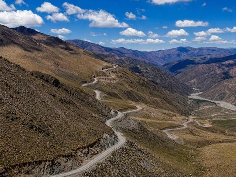
Abra del Acay (Ruta 40)
At 4895 meters this is the highest point of the legendary Ruta 40 and one of the highest road passes on earth. Lonely gravel, zero services, and altitude sickness is the real hazard. Carry fuel, water and warm gear, 4x4 recommended. #mountain-pass #unpaved #seasonal
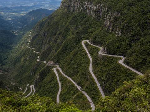
Serra do Rio do Rastro
A wall of stacked hairpins climbing 1400 meters out of the coastal plain, best seen from this mirante at the top. The road is paved and well kept but fog can erase it in minutes, and at night the illuminated curves are unforgettable. #hairpins #scenic #cliff
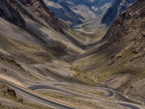
Los Caracoles (Paso Los Libertadores)
A staircase of tight switchbacks climbing to the Chile Argentina border at over 3000 meters. Shared with heavy trucks and buses, icy much of the year, snow chains often mandatory and the pass closes completely in storms. Spectacular seen from above. #hairpins #mountain-pass #seasonal #scenic
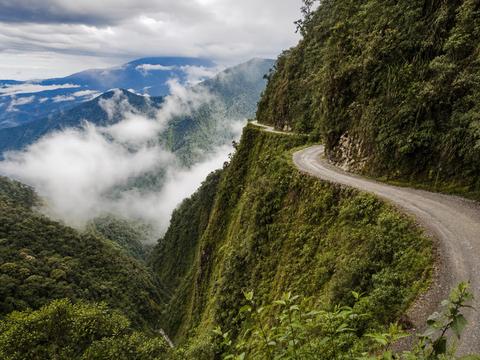
North Yungas Road (Death Road)
The original Death Road. A 3 meter wide gravel ledge with 600 meter drops into the jungle and no guardrails. Downhill traffic keeps to the cliff side by local rule. A paved bypass now carries most cars, so today it belongs to mountain bikers and thrill seekers. #cliff #unpaved #guardrails-optional #scenic
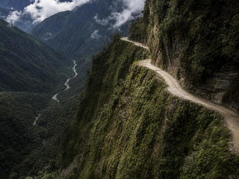
Trampolín de la Muerte
The Trampoline of Death between Mocoa and San Francisco. A narrow dirt ledge through permanent cloud forest fog, with landslides and sheer drops that have killed hundreds. Rain turns it to mud fast. 4x4 or a trail bike and dry season timing strongly advised. #cliff #unpaved #guardrails-optional
Asia
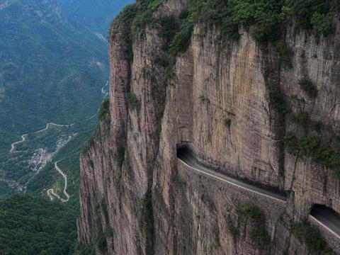
Guoliang Tunnel
A 1.2 kilometer tunnel hand carved through a cliff face in the 1970s by thirteen villagers who wanted a road to the outside world. Rough rock walls, a low ceiling and windows opening straight onto the void. Drive slowly and use the windows for photos. #tunnel #cliff #scenic
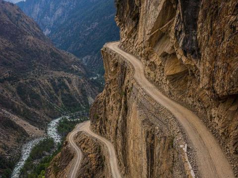
Kishtwar Killar Cliffhanger Road
The infamous Chenab valley shelf road between Kishtwar and Killar. A rough ledge blasted under overhanging rock, wide enough for one vehicle, with an unguarded drop of several hundred meters to the river. 4x4 and steady nerves required, avoid the rains. #cliff #unpaved #guardrails-optional
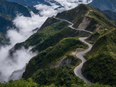
Halsema Highway (Highest Point)
The highest point of the Philippine highway system at about 2255 meters, on the mountain spine between Baguio and Bontoc. Landslides, ravines and buses passing in fog built its reputation, and the rainy season is still serious business. #mountain-pass #seasonal #cliff
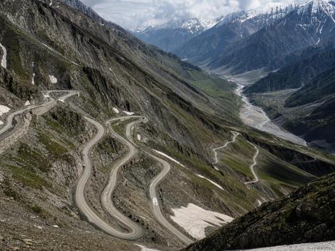
Zoji La
The 3528 meter gateway between Srinagar and Ladakh. Mud surfaced single lane sections hang over huge drops while army convoys squeeze past. Snow closes it for much of the year and avalanche control dictates the schedule. #mountain-pass #unpaved #seasonal #cliff
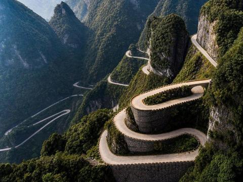
Tianmen Mountain Road (99 Bends)
Tongtian Avenue, the road to heaven. 99 bends gaining about 1100 meters up Tianmen Mountain to the natural arch at the summit. Most visitors now ride the park bus or the cable car, which is arguably safer than sharing the bends with one. #hairpins #mountain-pass #scenic
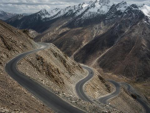
Khardung La
The famous signposted pass above Leh, long marketed as the highest motorable road in the world. The tarmac is decent now, the danger is thin air at a signposted 5359 meters. Acclimatize in Leh first and start early before the weather turns. #mountain-pass #seasonal #scenic
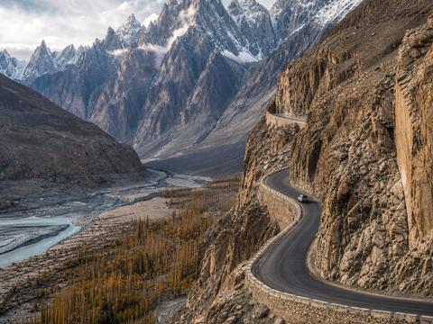
Karakoram Highway (Passu Cones)
The most photogenic stretch of the KKH, running beneath the jagged spires of the Passu Cones. The asphalt is good these days but rockfall, glaciers pressing on the valley and the Attabad landslide history remind you what mountains you are in. #scenic #mountain-pass
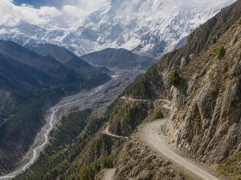
Fairy Meadows Road
A jeep track clawed into a dirt cliff from Raikot Bridge up toward Nanga Parbat. One lane, no barriers, hundreds of meters of air below your tire. Only local drivers are allowed to run it, then you walk the final stretch to Fairy Meadows. #cliff #unpaved #guardrails-optional
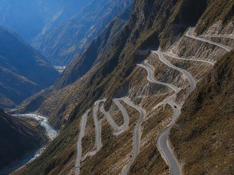
Nujiang 72 Turns (G318)
The famous 72 turns dropping nearly 2000 meters from Yela Mountain toward the Nujiang river on the Sichuan Tibet highway. An endless ribbon of hairpins shared with heavy trucks, best absorbed from the viewing platforms partway down. #hairpins #mountain-pass #scenic
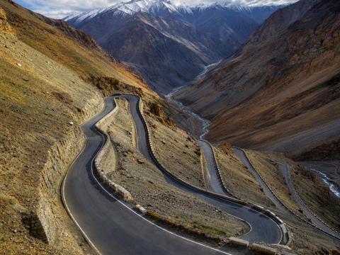
Gata Loops (Leh Manali Highway)
21 numbered hairpins stacking up from the Sarchu plains, climbing toward Nakee La at over 4700 meters. Altitude, loose edges and a famous ghost shrine where drivers leave water bottles for the spirit said to haunt one of the loops. #hairpins #mountain-pass #seasonal
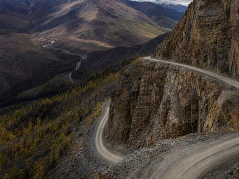
Kolyma Road of Bones (Oymyakon)
The Kolyma highway detour to Oymyakon, the coldest inhabited place on earth. Built by Gulag prisoners whose remains lie under the roadbed, hence the name. In winter the road is ice at minus 50, in summer the thaw turns sections to swamp. Total self sufficiency required. #unpaved #seasonal #scenic
Europe
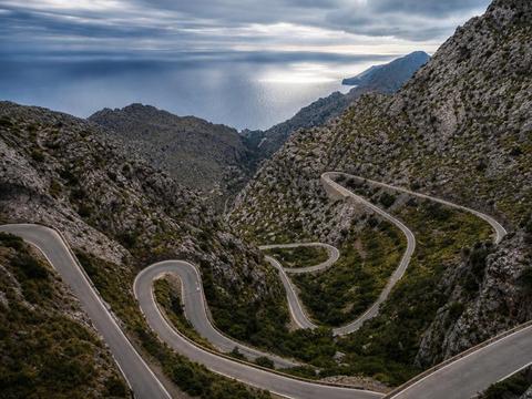
Sa Calobra (Nus de sa Corbata)
The tie knot road. 12 kilometers of curves dropping 800 meters to a hidden cove, famous for this 270 degree loop that ties over itself. Narrow, packed with cyclists and buses in season, and you must drive it twice because it dead ends at the sea. #hairpins #scenic #cliff
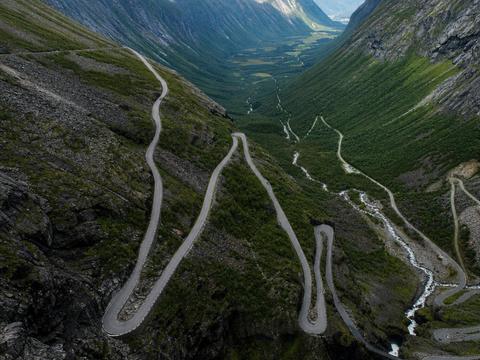
Trollstigen
The Troll Ladder. Eleven hairpins on a 10 percent grade stitched into a mountain wall, with the Stigfossen waterfall crashing beneath the road. Viewing platforms hang over the valley at the top. Snow closes it roughly October to May. #hairpins #seasonal #scenic #cliff
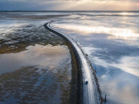
Passage du Gois
A 4 kilometer causeway that drowns twice a day. The Atlantic covers the road at every high tide and cars that ignore the posted timetable are regularly swallowed, which is why rescue towers line the crossing. Check the tide table and cross around low tide only. #tidal #scenic
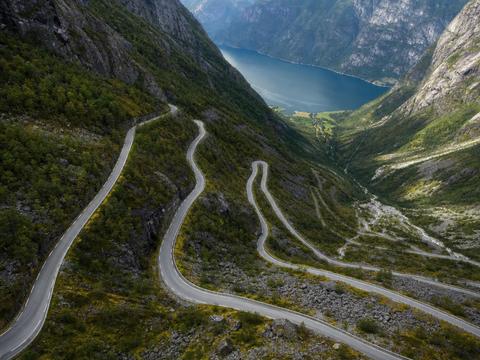
Lysevegen
27 hairpins falling about 900 meters from the Kjerag plateau down to Lysebotn at the head of Lysefjord, including a tunnel that corkscrews inside the mountain. One lane in places, open only in the snow free months. #hairpins #tunnel #seasonal #scenic
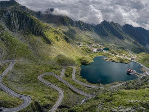
Transfăgărășan (Bâlea Lake)
Ceausescu's mountain crossing and the road Top Gear called the best in the world. The northern ramp to Bâlea Lake is a glacial valley stuffed with hairpins topping out at 2042 meters. Open roughly July to October and packed on summer weekends, go at dawn. #hairpins #mountain-pass #seasonal #scenic
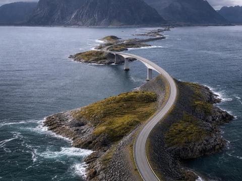
Atlantic Ocean Road (Storseisundet Bridge)
The curling bridge that looks like it launches cars into the sea when seen head on. The Atlantic Road hops eight bridges across open ocean, and in autumn storms waves break clean over the tarmac. Sunny days are scenic, storm days are the real experience. #scenic #seasonal
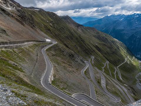
Stelvio Pass
48 numbered hairpins on the Prato side climbing to 2757 meters, the highest paved pass in Italy and a shrine for drivers and cyclists alike. Watch for buses swinging wide, hundreds of motorbikes and snow possible even in July. Closed November to May. #hairpins #mountain-pass #seasonal #scenic
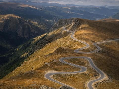
Transalpina (Pasul Urdele)
Romania's highest paved road, topping out near 2145 meters at Urdele Pass. Quieter and wilder than its famous sibling, with grassy ridgelines, sheepdogs and sudden fog. Many stretches have no barriers at all and winter closes it for months. #mountain-pass #seasonal #guardrails-optional #scenic
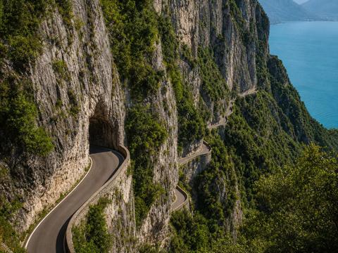
Strada della Forra
Churchill supposedly called it the eighth wonder of the world. A one lane road corkscrewing through a limestone gorge above Lake Garda, through tunnels barely wider than the car, with traffic light controlled sections. James Bond drove it in Quantum of Solace. #tunnel #cliff #scenic
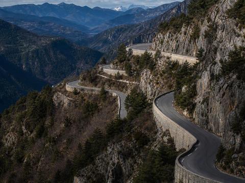
Col de Turini
The most famous stage of the Monte Carlo Rally, a 1607 meter pass climbing out of the Mediterranean hinterland in an endless chain of tight bends. Legendary on winter rally nights when black ice hides in the shadows. A superb driving road most of the year. #hairpins #mountain-pass #scenic
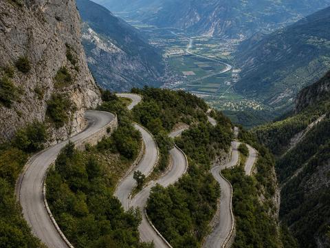
Lacets de Montvernier
18 hairpins stacked directly on top of each other in barely 3 kilometers, sewn onto a cliff face above the Maurienne valley. A Tour de France icon that looks hand drawn from the air. Very narrow, and if you meet a car someone reverses. #hairpins #cliff #scenic
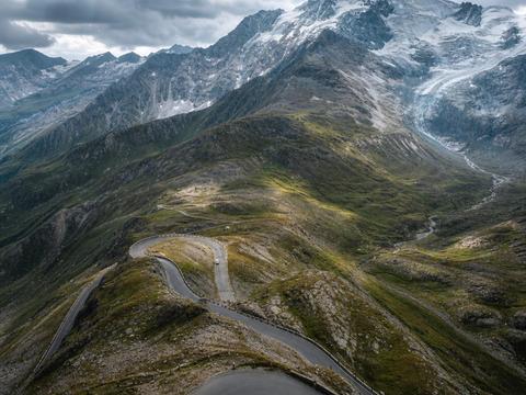
Grossglockner (Edelweissspitze)
The panoramic summit of the Grossglockner High Alpine Road at 2571 meters, reached by a short cobbled spur of extra hairpins. 36 bends in total, Austria's highest peak in front of you and marmots on the verges. Toll road, open May to early November. #hairpins #mountain-pass #seasonal #scenic
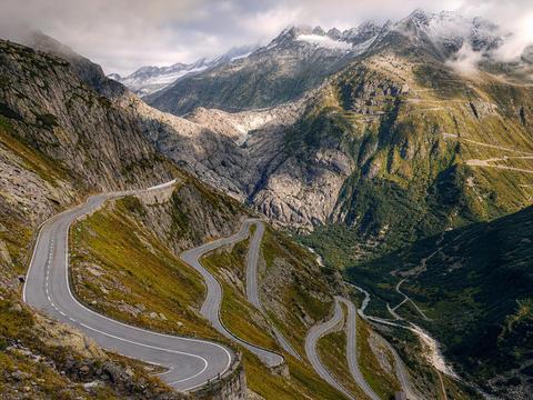
Furka Pass
The 2429 meter Swiss pass where the Goldfinger Aston Martin chase was filmed. Narrow, partly unguarded tarmac swinging past the Rhone glacier, shared with postal buses that have absolute priority. Closed roughly October to June. #mountain-pass #hairpins #seasonal #guardrails-optional
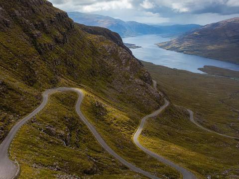
Bealach na Bà (Applecross)
The Pass of the Cattle, Britain's closest thing to an alpine road. Single track with passing places, 20 percent gradients and hairpins climbing to 626 meters over to Applecross. The famous sign at the bottom warns learner drivers away. Often impassable in winter. #hairpins #mountain-pass #seasonal #scenic
North America
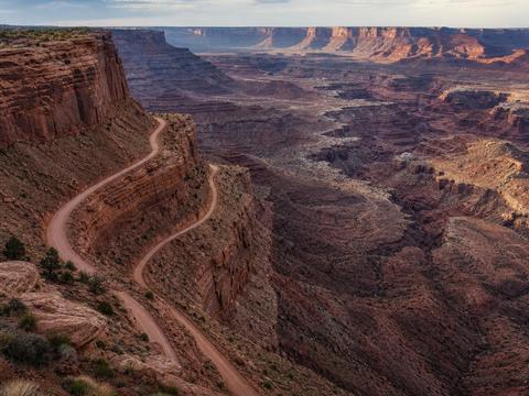
Shafer Trail
The dirt road that plunges off the Island in the Sky mesa in Canyonlands via a stack of exposed switchbacks. High clearance or 4x4 recommended, impassable when wet, no barriers anywhere. This overlook shows the whole descent in one glance. #unpaved #cliff #guardrails-optional #scenic
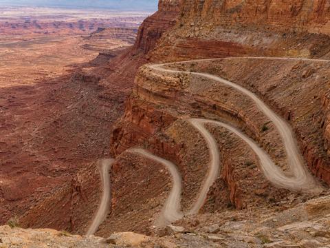
Moki Dugway
Three miles of gravel switchbacks carved into the face of Cedar Mesa, dropping 335 meters at an 11 percent grade into the Valley of the Gods. Graded dirt, fine for careful passenger cars when dry, with monumental desert views the whole way down. #unpaved #hairpins #cliff #scenic
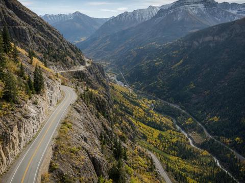
Million Dollar Highway
US 550 through the Uncompahgre Gorge between Ouray and Silverton. Narrow lanes cut into the cliff with no guardrails on the drop side, and in winter it crosses some of the most active avalanche paths in Colorado. Breathtaking in autumn color. #cliff #guardrails-optional #mountain-pass #scenic
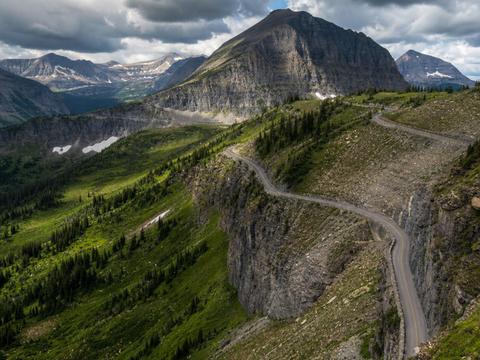
Going-to-the-Sun Road (Logan Pass)
Glacier National Park's alpine traverse, hanging on cliff ledges as it climbs to Logan Pass at 2026 meters. Vehicle size limits apply, snow walls tower over the road in early summer, and the full crossing is typically open only from about July to October. #cliff #mountain-pass #seasonal #scenic
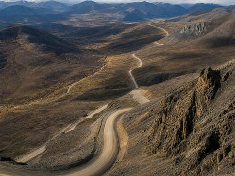
James Dalton Highway (Atigun Pass)
The haul road to the Arctic oilfields, 666 kilometers of gravel with almost no services, crossing the Brooks Range here at Atigun Pass. Truckers own the road, flying stones crack windshields, and winter brings whiteouts and avalanches. Carry two spares and extra fuel. #unpaved #mountain-pass #seasonal
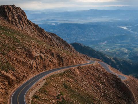
Pikes Peak Highway
The road of the famous hill climb, 156 corners rising to the 4302 meter summit. Fully paved now and patrolled, with a mandatory brake temperature check on the way down. Weather flips from sunshine to hail in minutes near the top. #hairpins #mountain-pass #seasonal #scenic
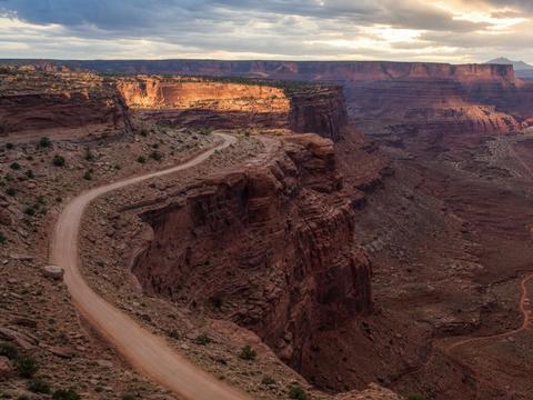
White Rim Road
A 160 kilometer 4x4 loop below the Island in the Sky rim in Canyonlands, tracing a white sandstone bench high above the Colorado and Green rivers. Permits required, no water anywhere, serious exposure in places. Most parties take two days. #unpaved #cliff #scenic
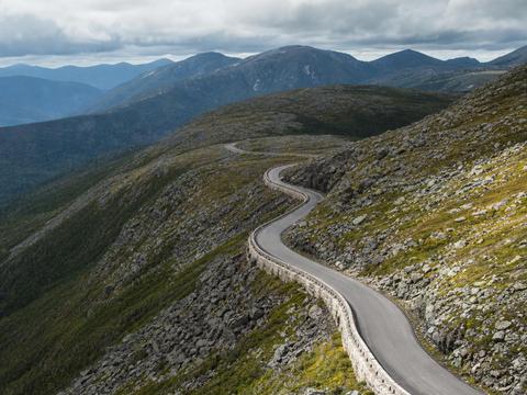
Mount Washington Auto Road
America's oldest man made attraction, climbing about 1400 meters in 12 kilometers to the summit with the worst weather in the world, once home to a 372 km/h wind record. Steep, partly unguarded, and coming down your brakes matter far more than your engine. #mountain-pass #seasonal #cliff
Oceania & Africa
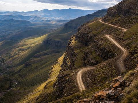
Sani Pass
The rough mountain ladder from South Africa into Lesotho, topping out at 2876 meters beside the highest pub in Africa. 4x4 legally required, the upper hairpins are loose and washed out, and winter brings snow and ice. Border posts at both ends, bring your passport. #mountain-pass #unpaved #hairpins #seasonal
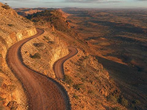
Canning Stock Route (Wiluna Trailhead)
The start of the longest and most remote historic stock route on earth, about 1850 kilometers of desert track and nearly a thousand dunes from Wiluna to Halls Creek. Weeks of fully self sufficient 4x4 travel with fuel drops arranged in advance and no rescue nearby. The ultimate outback test. #unpaved #seasonal
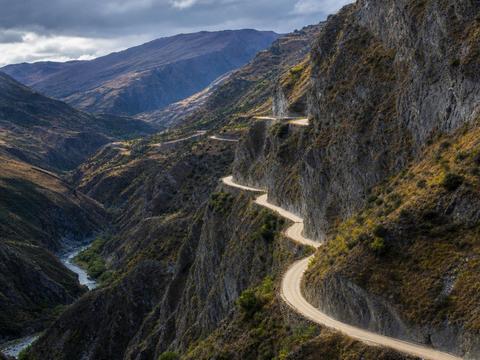
Skippers Canyon Road
A gold rush era shelf road blasted into schist high above the Shotover River near Queenstown. So narrow and exposed that rental car insurance is void here, one of the few roads in the world with that honor. Reversing for oncoming traffic is part of the deal. #cliff #unpaved #guardrails-optional #scenic
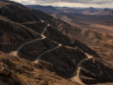
Van Zyl's Pass
Kaokoland's notorious descent into the Marienfluss valley, driven strictly westward downhill only. Rock steps that need a spotter, and experienced convoys still take hours for a few kilometers. Deep in Himba country with total remoteness, arguably Namibia's hardest pass. #unpaved #cliff #guardrails-optional #scenic