Geographic Oddities: Enclaves, Borders & Impossible Places

All 42 places on this map are pinned at their exact location, grouped into 5 areas (Enclaves & Exclaves, Borders Through Buildings & Towns, Nobody's Land & Everybody's Land and more). Each one comes with a short note on what it is and why it is worth your time. Browsing is free, and with an Ikuzo account you can copy the whole map and reshape it into your own trip.
Enclaves & Exclaves
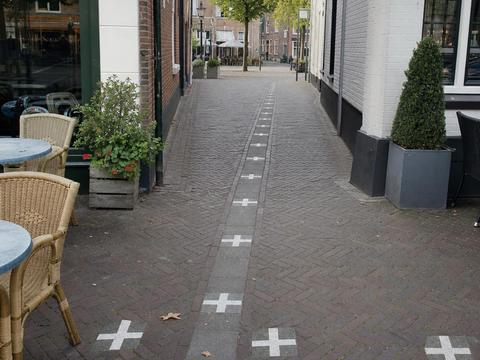
Baarle-Nassau & Baarle-Hertog
The world's messiest border, 22 Belgian enclaves inside the Netherlands and 8 Dutch counter enclaves inside those, with the line running through shops, cafes and front doors, marked by white crosses on the pavement. Fully open to visit, just walk the town and hop countries every few meters. #enclave #border #divided-town
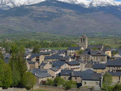
Llívia
A Spanish town stranded inside France since the 1659 Treaty of the Pyrenees, which ceded villages to France, but Llívia counted as a town so it stayed Spanish. Drive in on the neutral road from Puigcerdà, completely open. #enclave #exclave #border
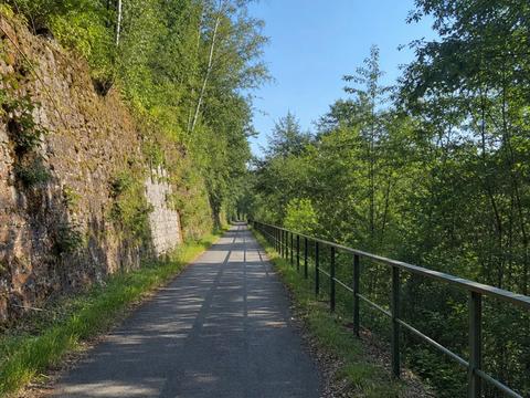
Vennbahn Corridor
An old railway trackbed owned by Belgium slices through Germany and turns five patches of German land west of it into exclaves. Today it is a gorgeous 125 km cycling route, ride it and weave between the two countries all day. #exclave #border
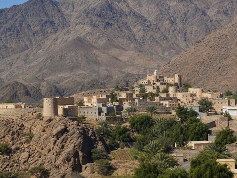
Madha
An Omani enclave fully surrounded by the United Arab Emirates in the Hajar mountains. Drive in freely, there is no checkpoint, the road signs and flags just switch. #enclave #border
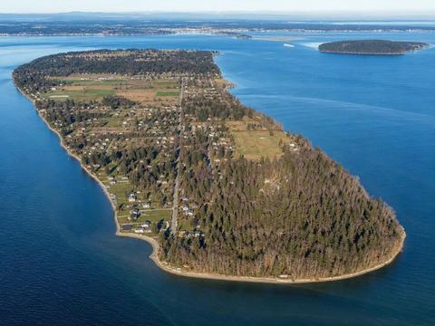
Point Roberts
The tip of a Canadian peninsula that dangles just below the 49th parallel, so it is US soil reachable by land only through Canada. Bring your passport, residents clear two borders to reach the rest of Washington State. #exclave #border
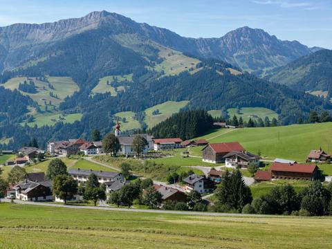
Jungholz
An Austrian village connected to the rest of Austria at a single mountain summit point, so every road in arrives from Germany. A quiet ski and hiking hamlet, open to everyone. #enclave #exclave #border
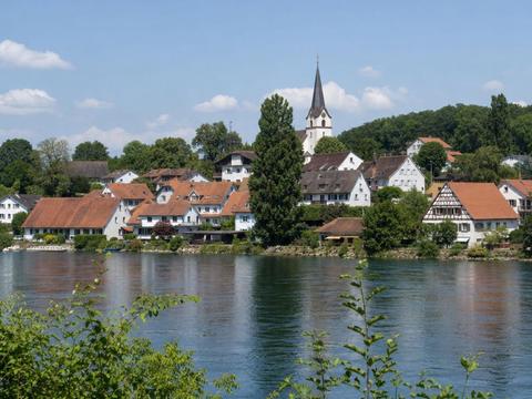
Büsingen am Hochrhein
A German town completely surrounded by Switzerland, it uses Swiss francs, has both German and Swiss postcodes and belongs to the Swiss customs area. Easy to visit from Schaffhausen, no border checks at all. #enclave #exclave #border
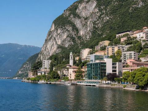
Campione d'Italia
An Italian exclave on the shore of Lake Lugano, entirely surrounded by Swiss territory and famous for its giant casino. Free to visit, buses and boats from Lugano cross without formalities. #enclave #exclave #border
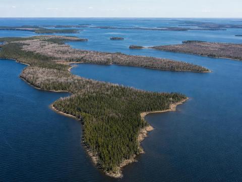
Northwest Angle
The northernmost point of the contiguous US, a chunk of Minnesota cut off by Lake of the Woods thanks to a mapmaking error in 1783. Drive through Manitoba and self report at a videophone border booth, or arrive by boat across the lake. #exclave #border
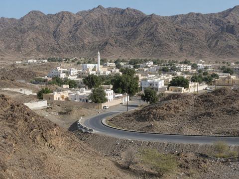
Nahwa
A piece of the UAE inside the Omani enclave of Madha, which itself sits inside the UAE. A rare second order enclave, country inside country inside country. Freely drivable, blink and you cross three jurisdictions in minutes. #enclave #border
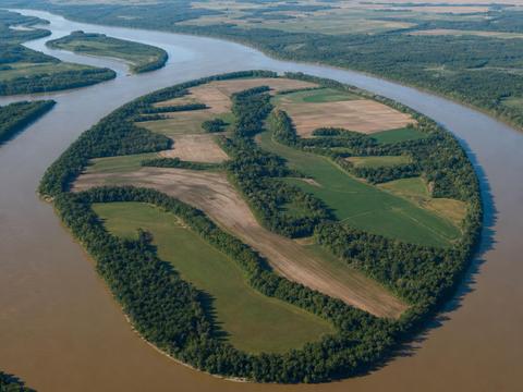
Kentucky Bend
A Kentucky exclave trapped in a loop of the Mississippi River, bordered by Tennessee on land and Missouri across the water, home to about ten people. One dead end road leads in via Tennessee, expect farmland, river views and total quiet. #exclave #border
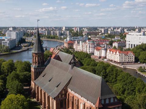
Kaliningrad
Russia's Baltic exclave, the old Prussian Königsberg, separated from the rest of the country by Poland and Lithuania. Visiting currently requires a Russian visa and careful planning given the political situation. #exclave #border
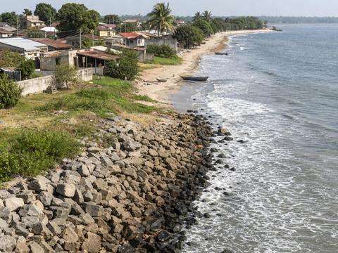
Cabinda
An Angolan province separated from the rest of Angola by a strip of DR Congo that gives Kinshasa its only access to the sea. Oil rich and politically sensitive, check current safety advice before considering a visit. #exclave #border
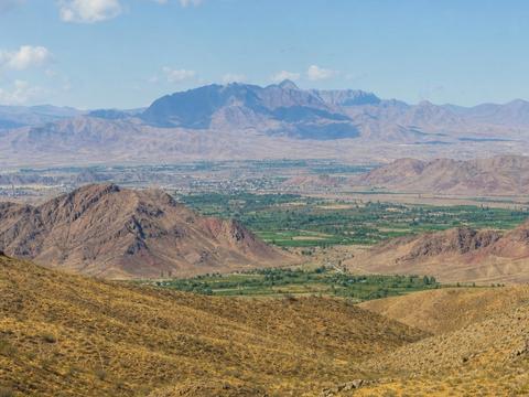
Nakhchivan
An Azerbaijani exclave cut off from Azerbaijan proper by Armenia, reachable from the rest of the country only by air or via Iran and Turkey. Open to travelers, most fly in from Baku. #exclave #border
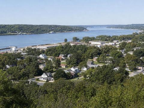
Carter Lake
An Iowa city stuck on the Nebraska side of the Missouri River after an 1877 flood shifted the channel, leaving the state line in the abandoned riverbed. Drive in from Omaha, the airport road passes right through it. #exclave #border
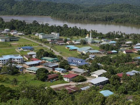
Bangar (Temburong)
Brunei's Temburong district is severed from the rest of the country by Malaysia's Limbang corridor. Until the 30 km Temburong Bridge opened in 2020, crossing your own country meant a boat or four border stamps. Visit for the pristine Ulu Temburong rainforest. #exclave #border
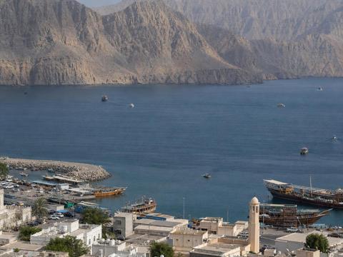
Musandam (Khasab)
Oman's fjord filled exclave guarding the Strait of Hormuz, separated from the rest of the country by UAE territory. An easy trip from Dubai with a land border crossing, dhow cruises and dolphins await. #exclave #border
Borders Through Buildings & Towns
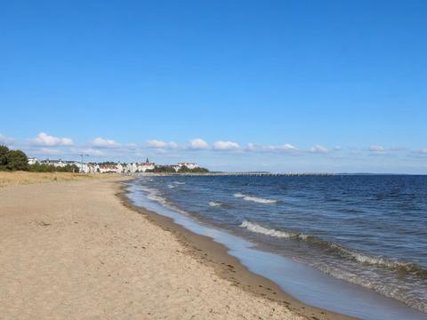
Usedom Beach Border (Ahlbeck / Świnoujście)
The German Polish border cuts straight across the beach of Usedom island between Ahlbeck and Świnoujście, marked by a line of posts in the sand. Walk or cycle the seaside promenade from one country into the other, there have been no checks since Schengen. #border #divided-town
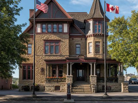
Haskell Free Library & Opera House
A library built deliberately astride the US Canada border, a black line crosses the reading room floor, the front door is in Vermont and most of the books sit in Quebec. Still visitable, but access rules for Canadian visitors tightened in 2025, check the current situation before you go. #border #divided-town
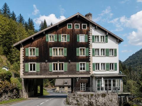
Hôtel Arbez Franco-Suisse
A hotel straddling the France Switzerland border in the village of La Cure, the line cuts through the dining room, the staircase and even some beds, so you can sleep with your head in one country and your feet in the other. Book a night or just have lunch in two countries at once. #border #divided-town
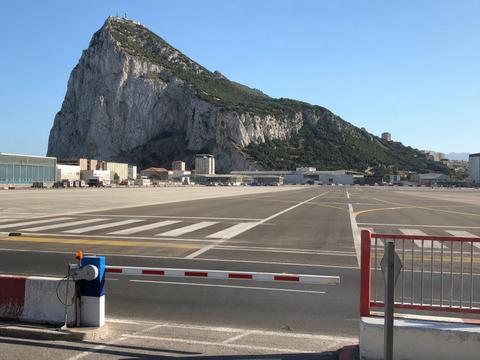
Gibraltar Airport Runway Crossing
For decades the only road between Spain and Gibraltar crossed an active airport runway, with barriers stopping cars and pedestrians for every landing. A road tunnel opened in 2023 so vehicles now go under, but you can still walk the famous runway crossing on foot when it is open. #border
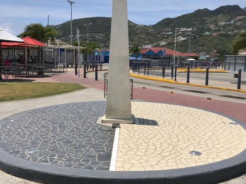
Saint Martin / Sint Maarten Border Monument
The smallest inhabited island divided between two countries, French Saint Martin and Dutch Sint Maarten have shared it peacefully since 1648 and there are no border controls at all. Drive across, only the road signs, the euro prices and your phone network tell you which side you are on. #border #divided-town
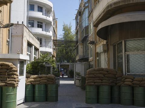
Nicosia Green Line (Ledra Street Crossing)
Nicosia is the world's last divided capital, a UN patrolled buffer zone of abandoned streets slices the old town between the Republic of Cyprus and the Turkish occupied north. Cross on foot at Ledra Street with a passport or ID and compare the two halves over two coffees. #border #divided-town
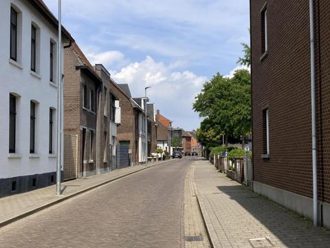
Nieuwstraat / Neustraße (Herzogenrath & Kerkrade)
In the twin towns of Herzogenrath and Kerkrade the Dutch German border runs down the middle of a shopping street. For decades a low wall divided the lanes and locals hopped it to smuggle coffee, today you can zigzag between the two countries with every step. #border #divided-town
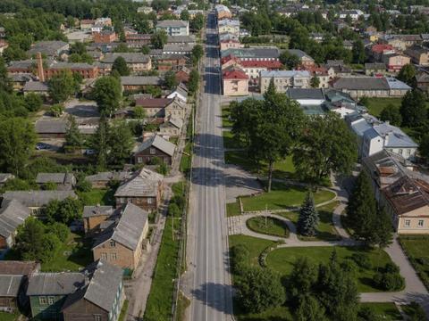
Valga / Valka Twin Town
One town, two countries. Valga in Estonia and Valka in Latvia grew as a single city and were split in 1920, today the local slogan is one city, two states. Schengen erased the checkpoints, so you can stroll back and forth across the line freely. #border #divided-town
Nobody's Land & Everybody's Land
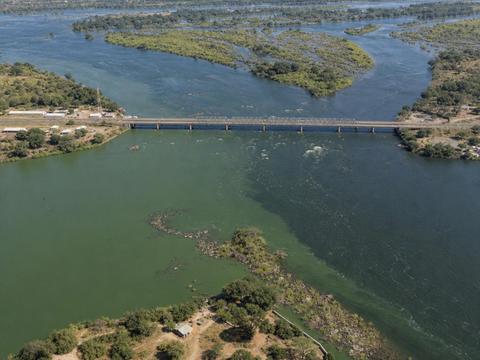
Kazungula Quadripoint
The closest thing to a four country point on Earth. Zambia, Zimbabwe, Botswana and Namibia nearly meet in the middle of the Zambezi River, technically two tripoints a few hundred meters apart. See it from the Kazungula Bridge or the ferry, with Victoria Falls just downstream. #tripoint #border
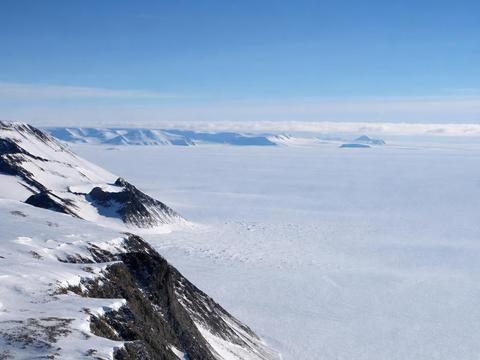
Marie Byrd Land
The largest unclaimed territory on Earth, a vast slab of West Antarctica that no country ever claimed when the continent was carved into pie slices. Visiting means a full polar expedition, this one is for the truly committed geography nerd. #unclaimed
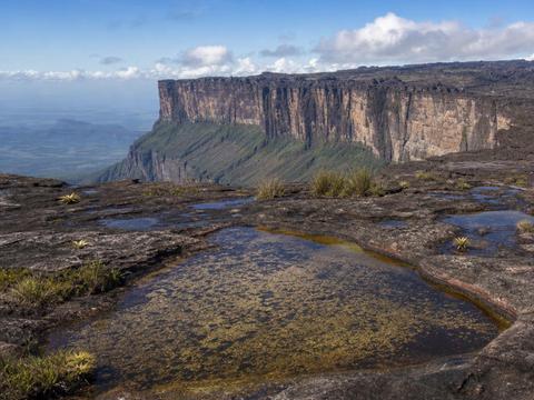
Mount Roraima Triple Point
The border marker of Venezuela, Guyana and Brazil sits on top of a two billion year old tabletop mountain that inspired The Lost World. Reachable via a spectacular multi day trek from the Venezuelan side, conditions and politics permitting. #tripoint #border
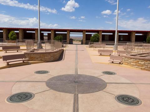
Four Corners Monument
The only place in the USA where four states meet, Arizona, Utah, Colorado and New Mexico, marked by a bronze disk on Navajo Nation land. Open to visitors for a small fee, the four limbs in four states photo is mandatory. #tripoint #border
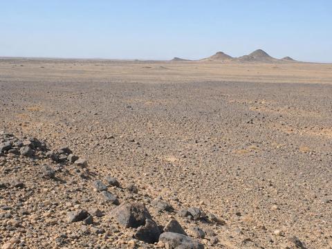
Bir Tawil
Two thousand square kilometers of desert claimed by nobody. Both Egypt and Sudan insist it belongs to the other, because each prefers the border version that gives them the neighboring Hala'ib Triangle instead. Effectively unvisitable without a serious desert expedition and military permissions. #unclaimed #border
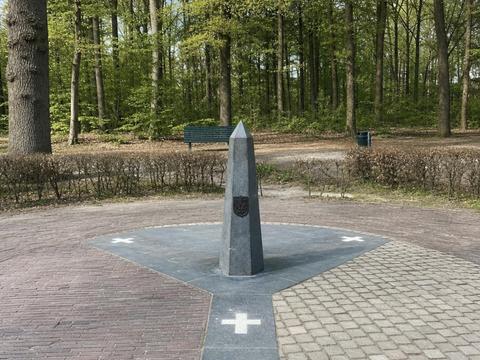
Drielandenpunt (Vaalserberg)
The Netherlands, Belgium and Germany meet on the highest hill of the mainland Netherlands, and for almost a century this was even a four country point thanks to the forgotten micro state of Neutral Moresnet. Very visitable, with a hedge labyrinth and viewing towers right at the tripoint. #tripoint #border #historic
Date Line & Coordinate Curiosities
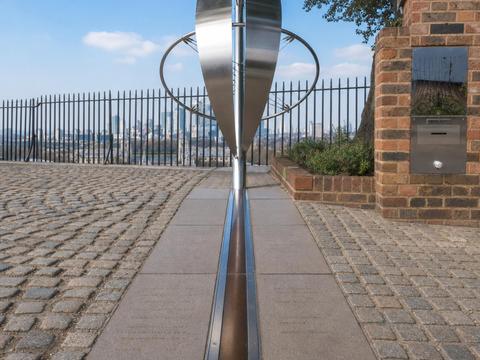
Royal Observatory Greenwich (Prime Meridian)
Home of the Prime Meridian, straddle the brass line where east officially meets west. Geography nerd bonus, your phone will read zero longitude about 102 meters east of the courtyard line, because satellite systems use a slightly different reference than the 1884 telescope. Museum entry fee. #dateline #historic
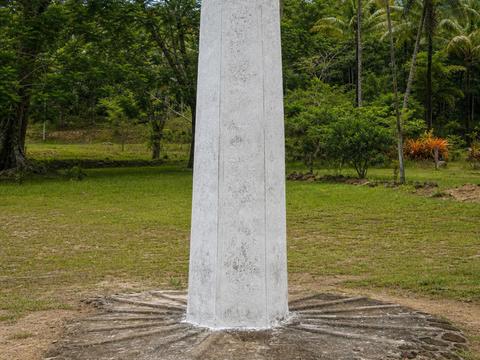
Taveuni 180th Meridian Marker
One of the very few places where the 180th meridian crosses land. A roadside marker on Taveuni lets you stand with one foot in the eastern hemisphere and one in the western, while the date line politely detours around Fiji so both feet stay in today. Easy stop near Waiyevo on the island's west coast. #dateline
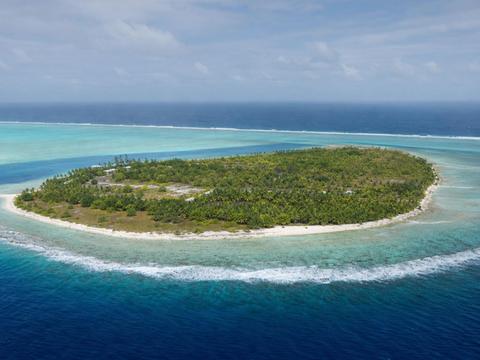
Caroline Island (Millennium Island)
Kiribati bent the International Date Line far to the east in 1995, putting this uninhabited atoll in UTC+14 and making it the first land on Earth to greet the year 2000. Extremely remote, visits are essentially private expedition only. #dateline
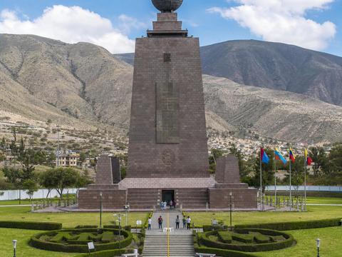
Mitad del Mundo
Ecuador's grand equator monument was built about 240 meters south of the actual equator, a fact GPS revealed long after construction. Still a fun visit near Quito, with museums, restaurants and the painted line everyone photographs anyway. #dateline
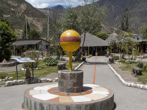
Intiñan Site Museum
A quirky museum just up the road from the misplaced monument, claiming to sit on the true equator line, with egg balancing and draining sink demonstrations, even though GPS says it is slightly off too. Cheap, kitschy and genuinely fun. #dateline
Null Island (0°N 0°E)
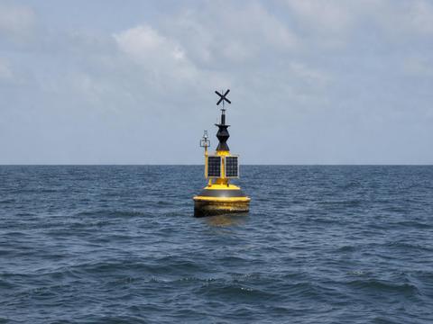
The point where the equator meets the prime meridian in the Gulf of Guinea. There is nothing here but open ocean and weather buoy Station 13010, nicknamed Soul, yet it is the most mapped nowhere on Earth because broken GPS data defaults to zero zero. Visiting requires chartering a boat off West Africa. #dateline
Miscellanea
Steinstücken
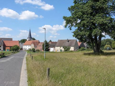
A tiny West Berlin exclave stranded inside East Germany during the Cold War, kept alive by US Army helicopters until a guarded corridor road opened in 1972. Now a peaceful neighborhood on the Potsdam border with a memorial made of two rotor blades. Free to wander. #exclave #historic
Tin Bigha Corridor (Cooch Behar Enclaves)
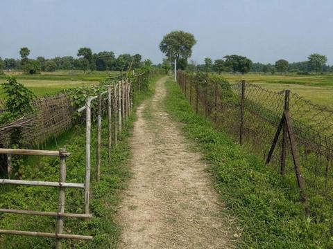
Ground zero of history's craziest border. The Cooch Behar complex once held over 160 enclaves, including the world's only counter counter enclave, an Indian field inside a Bangladeshi village inside an Indian enclave inside Bangladesh. The 2015 land swap resolved it all, and this corridor linking Dahagram to the rest of Bangladesh is the most tangible relic. #enclave #border #historic
Hans Island
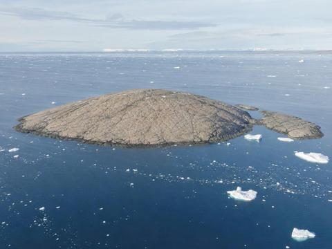
A barren Arctic rock disputed for decades in the Whisky War, Canadian and Danish teams took turns planting their flag and leaving a bottle of liquor for the other side. In 2022 the two countries simply drew a land border across the island, giving Canada and Denmark a shared land frontier. Practically unvisitable without an Arctic expedition. #border #historic
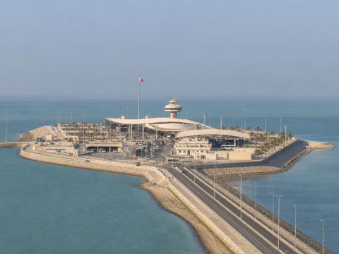
Passport Island (King Fahd Causeway)
An artificial island built mid sea on the King Fahd Causeway purely to host the Bahrain Saudi border posts, a land border crossing with no natural land under it. You pass through it whenever you drive between the two countries, complete with restaurants and viewing towers. #border
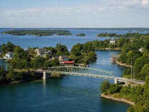
Zavikon Islands Bridge
Legend calls this tiny footbridge in the Thousand Islands the world's shortest international bridge, supposedly linking a Canadian island to an American one. In reality both islands sit in Canada, but tour guides keep the story alive anyway. See it on a Thousand Islands cruise from Rockport or Gananoque. #border